Category:Gasthuisstraat 14, Amerongen
Jump to navigation
Jump to search
| Object location | | View all coordinates using: OpenStreetMap |
|---|
house in Utrechtse Heuvelrug, Netherlands .jpg) | |||||
| Upload media | |||||
| Instance of | |||||
|---|---|---|---|---|---|
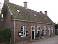
| Location | Amerongen, Utrecht, Netherlands | ||||
| Street address |
| ||||
| Located on street |
| ||||
| Heritage designation |
| ||||
 | |||||
|
This is a category about rijksmonument number 7748
|
| Address |
|
Media in category "Gasthuisstraat 14, Amerongen"
The following 10 files are in this category, out of 10 total.
-
 3958 Amerongen, Netherlands - panoramio (42).jpg 2,048 × 1,375; 681 KB
-
 Amerongen - Gasthuisstraat 14 RM7748.JPG 4,458 × 3,384; 3.2 MB
-
 Amerongen - Gasthuisstraat 22 F5.jpg 2,448 × 3,264; 2.87 MB
-
 Amerongen november 2010 (1).jpg 2,448 × 3,264; 2.13 MB
-
 Amerongen november 2010 (3).jpg 3,264 × 2,448; 2.12 MB
-
 Overzicht voorgevel, rechter zijgevel - Amerongen - 20001984 - RCE.jpg 1,190 × 1,200; 308 KB
-
 Overzicht, rechter zijgevel en voorgevel - Amerongen - 20370581 - RCE.jpg 1,190 × 1,200; 286 KB
-
 Voorgevel - Amerongen - 20370580 - RCE.jpg 1,191 × 1,200; 281 KB
-
 Weduwehuizen, gevels - Amerongen - 20008751 - RCE.jpg 1,200 × 817; 299 KB
-
 Zijgevel - Amerongen - 20008758 - RCE.jpg 1,200 × 963; 293 KB
.jpg)


.jpg)


